
History
Orland, originally called Vermont Settlement and populated by immigrants from Vermont, is the first settlement in Steuben County. Orland celebrates its heritage each year with the Vermont Settlement Festival in late July. After John Stocker, a Vermonter who had been prospecting for his family as well as his neighbors’ families, Orland was settled by John Stocker in 1834. Stocker chose this piece of land due to the abundance of burr-oak opportunities he discovered. Shortly thereafter, pioneers from Windham County, Vermont arrived and built a Baptist Church. [8] In 1837, the town opened a post office. [9]
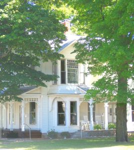
Orland, a stop along the Underground Railroad, was responsible for sheltering and protecting slaves as they made their way to Windsor, Upper Canada, in the years leading up to the Civil War. Russell Brown’s home was believed to have a second-floor apartment with a separate staircase in which up to 20 slaves could hide. S. U. Clark’s hotel was also said to have a secret hiding spot behind a basement cupboard. The Butler family south Orland “fed and shelter scores of them, and then took them to other stations.” “[10]
Brown, Clark and Benjamin Waterhouse were all arrested in the lead up to the Civil War for violating the Fugitive Slave Act of1850 at one point or another. Barry and Waterhouse were both convicted. Barry was sentenced to one hour in prison and paid a $30 fine. Other sources have the fine at $1000. [12]
In 1997, the National Register of Historic Places listed Fawn River State Fish Hatchery. [13]
The 2019-20 coronavirus pandemic saw confirmed cases of COVID-19 at a local meat processing facility run by Miller Poultry. This led to sanitation and the introduction of safety measures like temperature checks, social distance, and personal protective equipment. [14]
Geography[edit]
Orland can be found at 41deg43’50’’N 85deg10’11’’W.
According to the 2010 census Orland covers 0.66 square miles (1.71km2) of land. [15]
Demographics[edit]
Historical populationCensusPop.%+-1880416–1920322–1930310-3.7%1940307-1.0%195038625.7%19604249.8%19704577.8%1980424-7.2%1990361-14.9%2000341-5.5%201043427.3%2019 (est.)424[4]-2.3%U. S. Decennial Census[16]
2010 census[edit]
The population was 434 as of 2010[3], with 168 households and 117 families. The population density was 657.6 people per square mile (253.9/km2). The average housing unit density was 287.9/square mile (111.2/km2). The town’s racial makeup was 96.3% White, 1.2% African American and 1.6% from other race. There were 190 housing units at an average density of 287.9 per square mile (111.2/km2). 9.0% of the population was Hispanic/Latino of any race.
There were 168 households. 31.5% of these households had children younger than 18 years old, 53.0% had married couples living together, 10.7% had female householders with no husband, 6.0% had male householders with no wives present, and 30% were non-families. 28.6% of all households consisted of individuals and 14.3% were home to someone 65 years old or older. The average household size was 2.58, and the average family size 3.16.
The median age of residents was 40.2 years. 24% of residents were younger than 18, 9.2% were aged 18-24, 21.4% were between 25-44, 29% were between 45-64, 29% were between 45-64, 16.1% were 65 and older. The town’s gender composition was 50.0% male, 50.0% female.
2000 census[edit]
According to the 2000 census[5], there were 341 residents, 137 households and 90 families in the town. The average population density was 512.8 per square mile (199.5/km2). At an average density of 230.1 units per square mile (89.5/km2), there were 153 housing units. The town’s racial composition was 98.83% White with 0.29% Native American and 0.29% Asian. There were 153 housing units at an average density of 230.1 per square mile (89.5/km2). The population was 0.29% Hispanic and Latino of any race.
Orland, Indiana starting with 1876 Atlas
There were 137 households. 34.3% of these households had children under 18 years old, 49.6% had married couples living together, 12.4% were female householders with no husband, and 33.6% weren’t families. 29.2% of all households consisted of individuals and 13.9% were composed of someone 65 years or older. The average household size was 2.49, and the average family size 3.10.
The town had a spread population with 27.6% of the population under 18 years old, 8.2% of the population aged 18-24, 29.9% of the population aged 25-44, 19.9% of the population aged 45-64, and 14.4% of the population 65 years or older. The median age was 36. There were 100.6 males for every 100 females. There were 93.0 men for every 100 females over 18 years old.
The median income of a household was $38,542 and that of a family was $45,417. The median income for males was $33,438 while that of females was $20,893. The town’s per capita income was $15,188. The poverty line was reached by 9.2% of households and 7.9% percent of the population. This includes 11.4% of children under 18 years old and 7.7% of people 65 and older.
Education[edit]
The Joyce Public Library is a lending library in the town. [17]
Notable former residents and natives[edit]
Rollie Zeider (1883-1967), Major League Baseball player, 1910-1918. He played for the Chicago White Sox and Chicago Chi-Feds. Cass County was his birthplace. He grew up in Auburn and eventually opened a Garrett restaurant after retiring from baseball. In 1959, he moved to Orland, where he remained until his passing.
Azariah Southworth (May 13th 1986), Television producer/personality 2006.-2008
Andy Lee Graham, “The Hobo Traveller”,
Footnotes[edit]
^ “2019 U. S. Gazetteer Files”. United States Census Bureau. Retrieved July 16, 2020.
“US Board on Geographic Names” United States Geological Survey. 2007-10-25. Retrieved 2008-01-30
Jump up to:
a b “U.S. Census website”. United States Census Bureau. Retrieved 2012-12-11.
Jump up to:
a b “Population and Housing Unit estimates”. United States Census Bureau. May 24, 2020. Retrieved May 27, 2020.
Jump up to:
a b “U.S. Census website” United States Census Bureau. Retrieved 2008-01-30
See Sauer, Indiana DNR.
^ Taylor, et al., p. 26.
Lois Kimball Mathews, page 202: New England expansion: New England settlements and institutions spread to the Mississippi River 1620-1865
^ “Steuben County”. Jim Forte Postal History. Retrieved September 29, 2016.
^ Butler.
Indiana Department of Natural Resources Division of Historic Preservation and Archaeology
^ Sauer.
“National Register Information System”. National Register of Historic Places. National Park Service. July 9, 2010.
^ Duffy, Jamie (May 2, 2020). “Steuben meat plant reports positive tests”. The Journal Gazette
“G001 – Geographic Identifiers – 2010 Census Summary File 1. United States Census Bureau. Archived from the initial on 2020-02-13. Retrieved 2015-07-17.
“Census of Population and Housing”. Census.gov. Retrieved June 4, 2015
“Indiana Public Library Directory” (PDF). Indiana State Library. Retrieved 15 March 2018,
References[edit]
Marvin Benjamin Butler (1914). My story about the Civil War, Underground Railroad, United Brethren Publishing Establishment, Huntington, Ind.
Goodspeed, Weston A.
Indiana Department of Natural Resources, “Underground Railroad Site: Orland”, August 16, 2008.
Sauer, Lee, “Freedom Trail”: The Underground Railroad passed through northeast Indiana. KPC News.net accessed August 18, 2008.
Taylor, Robert M.; Stevens Errol Wayne; Ponder Mary Ann (1990). Indiana: A New Historical Guide. Indiana Historical Society. ISBN 978-0-87195-048-2.